Not a very long day here, but since we've got to cross the border back into the USA, and I'm a long-hair hippy freak kind of looking guy, I expect the customs people to give me a hard time, as they usually do, so I'm leaving a couple hours for the Airport of entry.
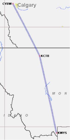
We'll leave Springbank Airport and head
south to Cut Bank Municipal airport (KCTB)
which is an "airport of entry", as long as you give customs a 2-hour head start.
From there, we'll head south along the eastern flank of the Rocky mountains
toward West Yellowstone, MT (KWYS).
The camping is supposed to be very nice there for an overnight.
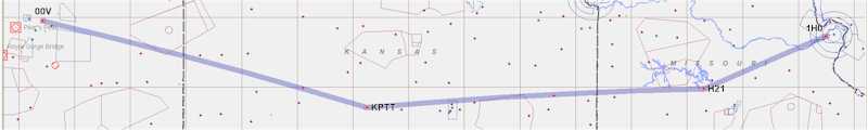
I woke early at Chrissi/Randi's house to check the weather and plan my flight. The northern half of both Missouri and Kansas was covered with rain showers and thunderstorms, so I reluctantly called Phil Weaver and told him that I wouldn't be able to get into the Kansas City area to visit (damn weather). The question was then whether or not to leave St. Louis at all, or try to wait a day or two for the front to pass. After looking at satellite pictures, radar pictures, and forecasts (and vacillating back and forth, driving Chrissi crazy) I decided to try to scoot through the southern half of MO and KS to get to Meadowlake Airport (00V) in Colorado to visit Burrall Sanders. It would be about a 4 - 4.5 hour flight, so I planned a stop about 1/2 way just in case.
Chrissi made another wonderful breakfast, and then we packed up and headed for the airport. I filled the tanks, packed the gear, and said goodbye. I was off the ground around 10:30 AM CDT - a little later than I had hoped, but not TOO late. Visibility was total crap - about 4 - 6 miles in haze. After getting out from under the St. Louis Class B airspace, I climbed up to 8500 ft., but that wasn't high enough to get over the haze. With a 15-20 mph headwind, I was making about 185 mph groundspeed, and I had to keep my head out of the plane all the time while hand flying, because there was no horizon at all. Lot's of blue up top, and brownish green below, but nothing in between. I could see some very large cumulus to the north, but the way forward continued to look clear. After getting stabilized, on course, and comfortable, I hooked up the MP3 player and listened to some tunes.
The flight was actually kind of boring, because I couldn't see a darn thing - just watching out for traffic (of which there was none whatsoever). After getting into Kansas, I climbed up to 10.5K ft. to get over some cumulus clouds whose tops were around 11K ft., but they were scattered enough to get around them easily. Some of the TS's to the north were becoming very visible, with tops into the 50K ft. levels. After passing Wichita, KS and coming up to Pratt Industrial, about in the center of KS, I decided to continue on with no fuel/bathroom stop - I was making decent time/speed, and was OK on the bladder issue (and if I wasn't, was going to test out one of those "porta-john" things - hey, you only live once). I called Kansas City Flight Watch to get a weather update, as it looked as though there was some weather ahead. They filled me in, and the TS's were north enough that I didn't have to worry - there were some light rain showers along my route, but visibility was getting better (maybe up to 15 - 20 miles) and I could see the clouds to avoid them. I turned on the oxygen after being at 10.5K ft. for an hour or so, and then climbed up to 12.5K ft to try to get above the haze layer to see the clouds better (and get over almost all of them). Still hazy, but better.
As I crossed into eastern Colorado, I was between layers, with a light rain on occasion, but visibility was still fine, and the clouds below were scattered, so I could still figure out where I was. There's NOTHING out there - it's flat and empty. Eventually the layer above disappeared, as did the layer below, and the visibility went up to 60-80 miles - more above the top of whatever haze was left. As I approached the HUGO VOR, about100 miles east of Colorado Springs, I could see some huge thunderheads/cumulus clouds ahead. I contacted Denver Flight Watch for an update, and they said that the TS's hadn't made it to Colorado Springs or Meadowlake Airport yet. CS ATIS was saying the same thing, so I continued on, pointing right at some HUGE clouds, but knowing that they were 20-40 miles past where I was going.
At some point the MP3 player's batteries got low, so I plugged in the 12V adapter into the power port, and started letting it recharge. A minute later, I started smelling some smoke, and my first thought, of course, was that something ELSE had gone wrong with the plane - hey, it wouldn't be the first thing, right? But then I realized that I had just plugged in the adapter, and sure enough, there was some smoke coming from it. I reached over and yanked it out of the power plug and disconnected it from the MP3 player. It stopped smoking, and Radio Shack is going to get an earful over this one :-).
Anyway, a new layer of puffy cumulus appeared below, but it was scattered, so no issue. Between Lamar, CO and Colorado Springs, CO is a pretty desolate place - a ranch here and there, but few roads, few houses, few plants (and the ground kept coming up at me :-) ). About 60 miles out, I descended to 10.5K ft (only about 4K ft. AGL), and then 25 miles further descended between the clouds to 8500 ft. Pattern altitude for Meadowlake Airport is 7900 ft., so I was almost there (that's my usual CRUISING altitude - it was very strange to be setting up to land there :-) ).
I finally got the airport in sight, and used the automated UNICOM (click three times and it tells you stuff). Mindful of density altitude concerns, I paid no attention to how fast it LOOKED like I was moving, and made sure to run my pattern at my normal indicated airspeeds. Even landing downhill (the Meadowlake runway is pretty steep, although it's hard to tell by looking at it), I was able to turn off in 3500 - 4000 ft, without braking very hard. There were some big storms off to the north, maybe 10-15 miles, but I had made it in without a hitch - FSS ensuring that I had the latest information along the way to be safe.
I hadn't contacted Burrall Sanders prior to take off (I should have), so I pulled out my cell phone while taxiing slowly and asked his wife where I should be going. Meadowlake is a private airport, with an airport community on it. I reversed direction, taxied out Echo taxiway past about a zillion hangars (there's a SEA of hangars there), crossed a road, and then Burrall (in his jeep) led me up a narrow, winding taxiway directly to his house. Very cool - Burrall and his wife have a beautiful house with a gorgeous view of the Rocky Mountains. He's got a flying V.E., a Piper Tri-Pacer, and a COZY III under construction. He also works on other folks aircraft, and has a finished Velocity in his hangar (separate from the house) with the Piper and V.E., and he has a Express project and Will Drexler's V.E. in his attached garage. Lot's of planes!
Burrall and his wife were extremely gracious hosts, putting me up on such short notice and taking me out to eat. They wouldn't let me pay for it, either.
So, except for missing a visit with Phil Weaver, this was a reasonable day. All sorts of weather, my longest single leg to date, a plane that ran and didn't have a major problem at the end of the day, and some excitement in the cockpit to keep me from getting complacent. Flying in Colorado with 100 mile plus visibility is beautiful.
Since neither Joseph Patterson nor Ronald Brooks will be available tomorrow in New Mexico, I will not be heading down there - Burrall and I MIGHT take an early morning flight up into the mountains, and I'm going to spend a bit of time at Meadowlake testing takeoff distances at different weights, but it seems as though the BBQ will be at Greeley (KGXY), so the Density Altitude Takeoff Testing will probably be a purely academic exercise.
Here are
a few pictures from the day's flight.
 |
 |
 |
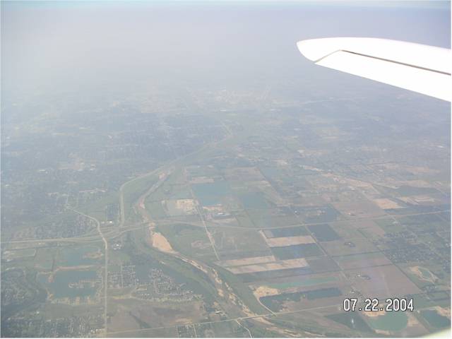
| Haze over Wichita - it was MUCH worse in
Missouri. Click on the thumbnail to see the larger version. |
Just another one of my cloud pictures - I've
got a fetish, I guess. Click on the thumbnail to see the larger version. |
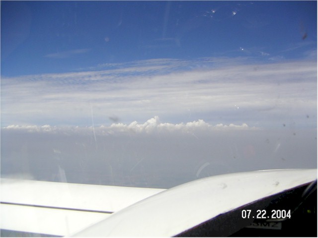
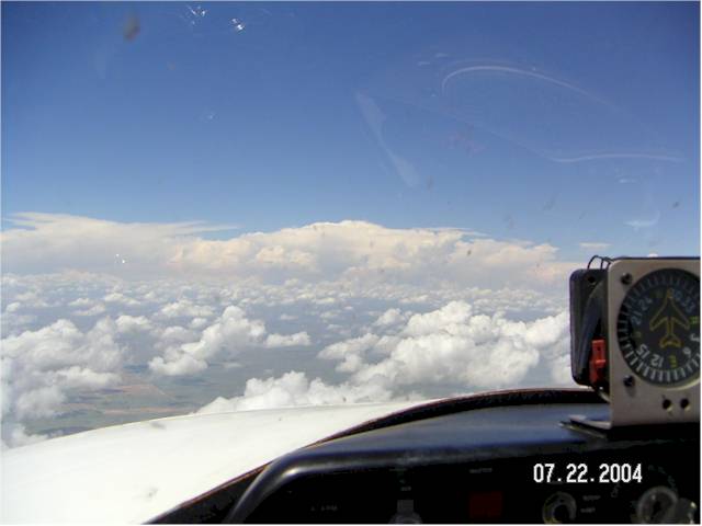
At least this picture of clouds has some
purpose - those are all thunderstorm clouds, with tops to 50K ft.
That's what I was skirting by going south instead of through the Kansas City
area. Click on the thumbnail to see the larger version. |
 |
 |
|
| Here's another nice picture of clouds over
eastern Colorado. Get used to it. Click on the thumbnail to see the larger version. |
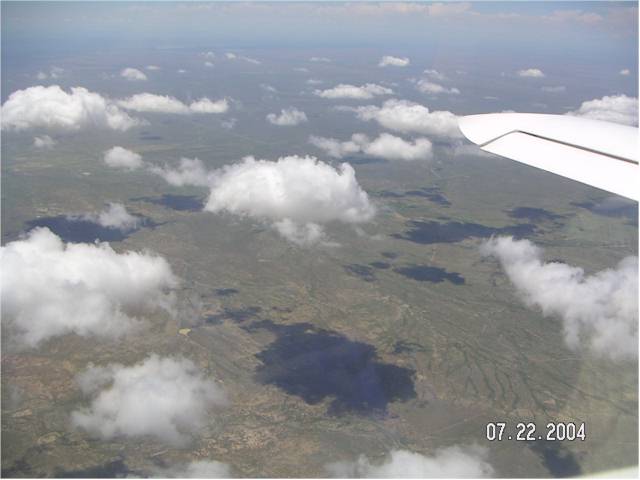
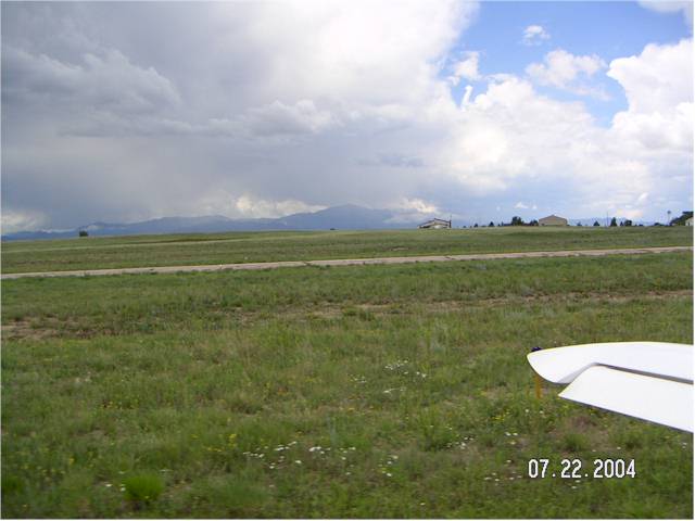
This is the ground about 80 miles east of
Colorado Springs. There isn't a freaking thing out here. Click on the thumbnail to see the larger version. |
|
 |
 |
 |
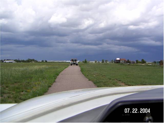
| I'm taxiing down Burrall Sanders' private
taxiway. Pretty cool, eh? Click on the thumbnail to see the larger version. |
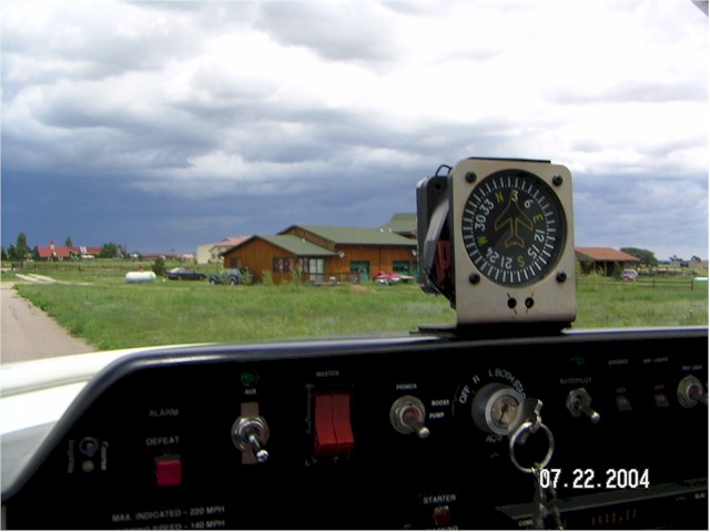
Here's Burrall's house. Click on the thumbnail to see the larger version. |
This is the view of Pike's Peak Burrall has
from his house. Click on the thumbnail to see the larger version. |
| [Zeitlin's Cozy MKIV Information] [Zeitlin's Cozy MKIV Logbook] [Cozy MKIV Information] |
Copyright © 2004, All Rights Reserved, Marc J. Zeitlin