[ Back ] [ Up ] [ Next ]
2010: Arlington Fly-In
Date: July 9, 2010
Having decided to attend the
Northwest EAA fly-in in Arlington, WA (north of Seattle),
I packed up my camping stuff, got the COZY ready, and got to the airport on
Friday morning around 6:30 AM. I would have liked to go up on Thursday so that I
could attend the yearly dinner flyout (this year, apparently they went to
Bremerton rather than Friday
Harbor, but either one would have been fine), but I couldn't take the
day off from work, since I'm going to be taking almost 2.5 weeks soon for OSH
and a vacation on the east coast.I was off the ground around 7 AM and headed
over to Bakersfield in the
San Joaquin Valley,
climbing to 8,500 ft. along the way. I picked up Flight Following, got a squawk
code, turned on the autopilot and headed north towards Sacramento. After
a slight turn to the north, I headed toward Redding, CA. I had originally
thought of going up to Crater Lake
for some sightseeing, but after some further study of the map and terrain, and
lack of airports, I decided that with only 7 hours on the Hobbs since the engine
rebuild, I wanted to stay closer to civilization. I climbed up to 10.5K ft. and
stayed to the west of Mt.
Shasta, overflew Siskiyou Airport, and then headed northwest
toward Roseburg, OR. I was essentially staying over I-5, for the most
part.
I could see the low fog and clouds toward the coast, on the west side of the
coastal hills, but the
Willamette Valley
was severe clear, as was the sky to the east. I could see
Crater Lake and the string of
volcanos as I headed north over Eugene, Corvallis, McMinnville
and Portland. I flew past
Mt. St. Helens
(having been there on a motorcycle trip between the two eruptions in 1980, I
have a special fascination with
Mt. St. Helens)
and could see Mt.
Rainier in the far distance to the north.
After passing Mt.
St. Helens, I descended to 4500 ft., slowed a bit, and went under the
Seattle Class B airspace to the east, going north to Arlington. I got to
the Green Valley airport, where the Arlington Approach Controllers were
stationed. I was the only one in the air, so I was able to talk to them rather
than just having them tell me what to do. No issues whatsoever on the approach
or landing, and the volunteers efficiently guided me to the canard
parking/camping area (lane 5).
I said hello to the folks already there - Joe Person, Tom Staggs, Ben
Winner, Dale Martin and many other folks who will now be insulted that I
didn't remember their names and include them in the list - and then set up my
tent and went to pay my $20 registration fee. I hung out looking at planes,
watching the airshow and yakking with everyone until the Tom Staggs
organized BBQ began at around 6 PM. Way more yakking, and eventually went to bed
around 10 PM.
Date: July 10, 2010
I was awoken early Saturday morning by folks generously condescending to run
their engines and take off around 6 AM, to ensure that those of us still
sleeping didn't miss any of the action, and to ensure that they didn't have to
deal with the ground volunteers or control tower. I got myself and the plane
ready, as I had agreed to give rides to Tim and Mary Dowling, who are
just starting a COZY MKIV project (working with Joe Person, who's
also starting a MKIV after building and flying two Variezes).
Around 8 AM we loaded up and taxied over to the gas pumps. After fueling, we
took off and headed north to the
Skagit Valley. We
passed Puget Sound
and the San Juan
Islands to our west and then headed east up the Skagit at around
3000 ft. Joe flew chase in his Varieze, and flew over us as I
demonstrated stalls. We headed back south over Paine Field in Everett, where
Boeing assembles 747's, 767's and 787's (and where both Joe and Tim work). Then
we headed back in to Green Valley, where we followed a few planes in for
landing at Arlington.
A bunch of us went out for breakfast/lunch at
IHOP, and then we hung around for the
afternoon, watching planes and telling stories. I ate some dinner with E.J.
Johnson and Steven Crouch, and then just hung out and relaxed for the
evening.
Date: July 11, 2010
The plan was to wake early, pack up the tent and get on the road (so to
speak) by 8 AM, so that I could get to the
Evergreen Museum in McMinnville by 9:30 AM and spend some time
at the IMAX theater and the
Spruce Goose.
But it was not to be - it was foggy with low clouds all morning, so I spent most
of the time eating some breakfast, packing up a wet tent, checking my email at
the internet cafe, and bugging the FSS folks continually about the weather (as
if they had some control). By 10:30 AM it was obvious that I wasn't going
to have time to hit the museum (they recommend 5 hours to see everything) and
still get to Tehachapi by dark,
so I changed plans and figured that as long as I got out of Arlington by
2 PM or so, there was no problem. I taxied over to the self-serve gas
pumps around 11 AM after packing up the plane and fueled up. I spent a bit of
time talking to a couple from Juneau, AK in a twin (Apache, I think) and
another couple in a Kitfox (from the same EAA chapter in Idaho as Jim
Price, of altitude record fame).
Around 11:45 AM, the sky looked clear enough to get above the cloud layer,
which topped out around 2K ft., so I taxied to the runway and was cleared for
takeoff at just about noon. I climbed through a hole (sea level climb
performance was a surprise again, after so long at high DA's) and was soon at
4500 ft. I got Flight Following from Seattle Departure and was cleared to climb
to 8500 ft. and transit the Seattle Class B airspace. I watched a few 737's go
by 500 ft. underneath me. There were clouds below for about 45 minutes until I
got just north of Portland, OR.
Back down the beautiful and well appointed (once again, with apologies to
James Montgomery)
Willamette Valley,
over the hills and down past
Mt. Shasta, and then
down the whole of the
San Joaquin Valley
to Bakersfield , and a short jog to the Tehachapi Valley.
Five hours and five minutes after takeoff, I landed at
Tehachapi, refueled the plane and
put it away.
Below you can see some of the many pictures I took on the trip north and
south. The camera does not do justice to the beautiful 360 degree views along
essentially the whole flight.
|
|

|
|
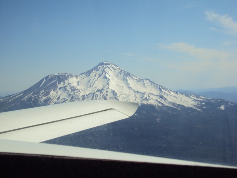
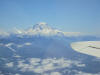
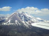
Mt. Shasta
A view from the southwest over the canard. I'm at 10.5K ft. - it's at 14,179 ft. The first of many volcanos along the route. |
|
|
|
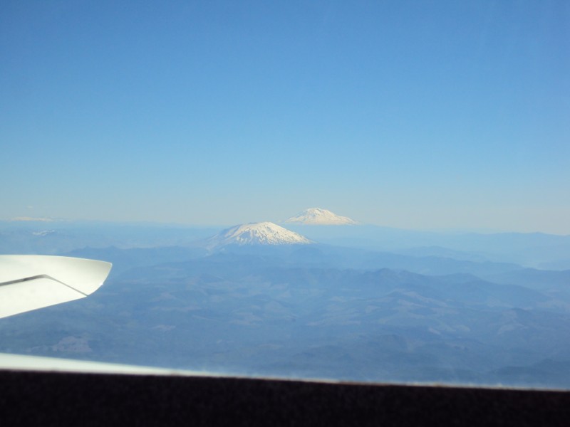
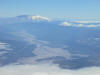
Mt. St. Helens
With another mountain/volcano in the distance |
|

|
|
Joe Person's Varieze
I took Mary and Tim Dowling (new COZY MKIV builders) for a ride, and Joe Person flew in loose formation. |
|

|
|
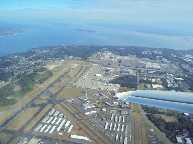
Paine Field
Boeing builds wide-bodies here - you can see 787's and 747's lined up on the ramp. |
|

|
|
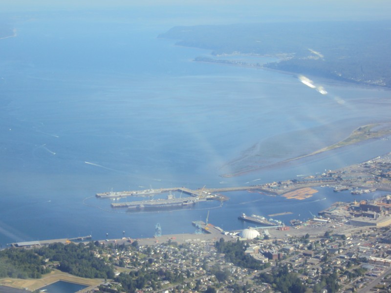
Puget Sound Naval Complex
With an aircraft carrier. |
|
|
|
|
|
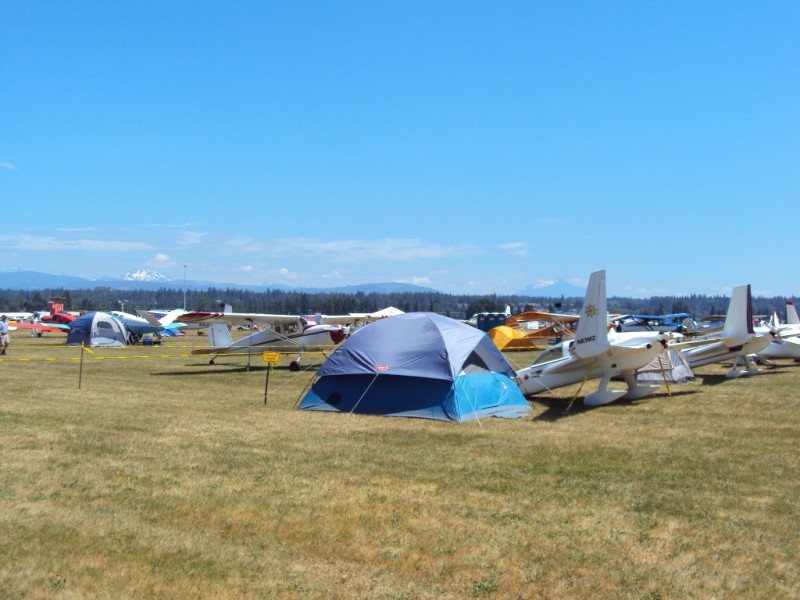
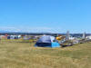
Arlington campsite, aircraft, and beautiful view
The Cascades in the background to the east and a clear blue sky. |
|
|
|
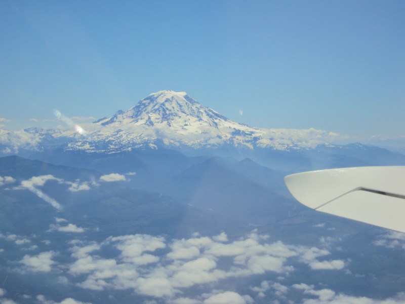
Mt. Rainier
A view from the northwest, on the way south. I'm at 7,500 ft. - it's at 14,411 ft. Although 100 ft. lower, it's way more impressive than Mt. Whitney, as it stands completely alone, essentially rising from sea level. |
|
|
|
Mt. St. Helens
A view from the west, looking up the Toutle River valley, which is still clogged with 30 year old debris. |
|
|
|
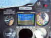
New Dynon D-10A
Notice the IAS of 162 mph, the TAS of 195 mph, the OAT of 65 F, and the DA of 12K ft. All this on 8.4 GPH. Magic carpet. |
|
|
|
Mt. Shasta
Mt. Shasta had it's own clouds and a lot of snow. The old lava flows were clearly visible. |
|
|
[ Back ] [ Up ] [ Next ]
Copyright © 2010, All Rights Reserved, Marc J. Zeitlin