[ Back ] [ Up ] [ Next ]
2005 - Owens Valley Tour to Bishop
Date: December 16, 2005
So on our trip to
Death Valley last weekend, we peeked up the
Owens Valley (that's
the valley on the east side of the
Sierra Nevada
Mountains in CA) as we headed east and said to ourselves "selves, we
should head up that way sometime, and see what's up there - that's what we
should do". We had been told that it's a nice flight up towards
Bishop and
Mammoth. So today (an off work
Friday), that's just what we did. While the weather in the
San Joaquin Valley to the WEST of the
Sierras was
miserable (1/2 mile visibilities, 600 ft ceilings, albeit with 2500 ft tops, so
it would be trivial to punch through with an Instrument Rating), the weather
over the mountains, over
Tehachapi, and to the northeast were severe clear, not a cloud in the
sky, and 100 - 120 mile visibilities. It's a flying day. Hell, just about
EVERY day is a flying day.
Before taking off, I spend about 10 minutes putting some velcro on a headrest
extension I made for Deanie. Since she's using a wedge shaped cushion
behind her back which sits her up straighter, her head is about 5" away from the
stock headrest. This worked very well, and is easily removable for larger folks
who don't want the cushion or the forward headrest.
We took off from Tehachapi
in a 15 kt. wind from the west, and headed northeast over the 6500 ft.
mountains towards Inyokern,
at the southern tip of the
Owens Valley, just
west of China Lake Naval Air Station
and the town of Ridgecrest.
The Inyokern airport is
hard up against the boundary of the
China Lake Restricted area, and if you take off on one of their runways
towards the northeast, you pretty much have to turn north when you reach 4 ft.
AGL to avoid entering the Restricted Area.
Inyokern (as are many of the
airports in the area) is a big gliderport - the soaring on the east side of the
Sierras is
something to behold, I'm told, with folks regularly getting up into the 20K ft -
30 K ft levels.
When we hit Inyokern, we
turned north around the corner of the
Sierras and
headed North up the Owens
Valley. Geez - we thought the trip to
Death Valley was pretty - each
flight we take is better than the last. The
Owens Valley is
around 20-40 miles wide, with 9K ft to 14K ft. mountains running hundreds of
miles continuously up either side. The valley floor is at about 2400 ft.
elevation at Inyokern, and
rises to around 4K ft. at Bishop,
106 NM to the north. We had considered going to
Mammoth, which is at 7100 ft., but
decided to stop at Bishop for
lunch.
We flew up the valley at 8500 ft. - about even with some of the peaks on either
side, and below many. It's impressive being 4K ft AGL, and having mountains 6K
ft above you on either side. The mountains in the
Sierras to the
west had a lot of snow on them, but the mountains on the right (don't know the
name of the range - maybe the Panamints?) had none whatsoever, until the really
tall ones north of Bishop.
It was an amazing view - 100 miles dead ahead, to snow-capped peaks towering
over our altitude, with towns and airports below, and huge mountains 5-15 miles
off to either side.
About 40 minutes later, we arrived over
Bishop, situated in the middle
of the valley with tremendous peaks surrounding it. We landed and taxied over
to the parking area in front of the restaurant, went in, and had some lunch.
Other than the service being a bit slow, the food was good, and the views from
the restaurant window towards the runway and the mountains in the background
were tremendous.
Around 3 PM, we climbed back in and took off. We headed south, back down the
valley (one day I'll climb up to 16.5K ft and head west over the
Sierras, but
it'll have to be a day when the
San Joaquin Valley looks a bit less like cream of mushroom soup) towards
Inyokern. We had a 15 Kt.
tailwind, and were screaming along at 193 Kts GS until we hit some turbulence
around Lone Pine for about
2 minutes. After we were through it, the winds had completely died, and we were
back down to 175 Kts GS. Just before
Inyokern, we turned southwest
into the sun and headed back to
Tehachapi, landing at about 3:45 PM.
Another successful day complete.
|
|
|
|
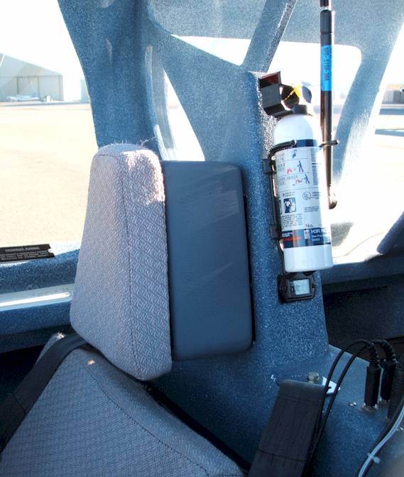
Headrest Extension
This moves the co-pilot's headrest further out to match the wedge seatcushion support. |
|

|
|
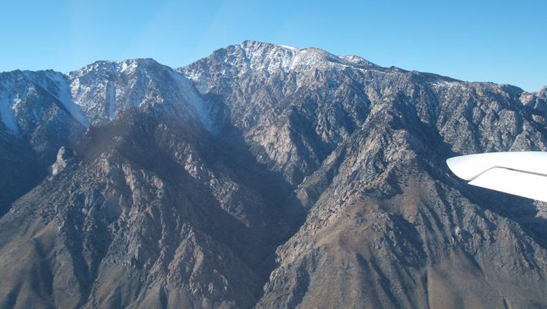
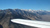
Sierras - Mountain
Not sure exactly which mountain this is, but it's 11K ft or so, viewed from 8500 ft. going north |
|
|
|
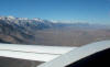
Sierras - Northwest
Looking Northwest, up the Owens Valley, at the bulk of the Sierra Nevadas |
|
|
|
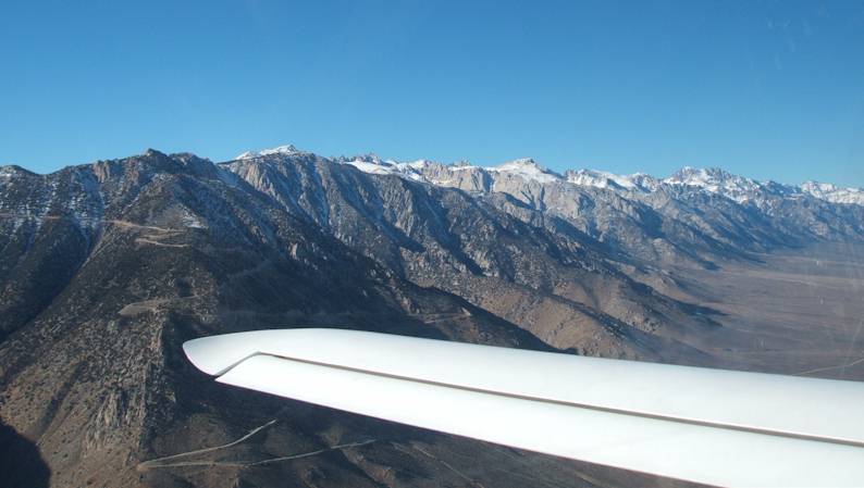
Sierras - North
Looking North up the Owens Valley, with the Sierras to the west |
|
|
|
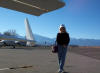
Deanie - Bishop
Deanie is standing near N83MZ on the Bishop Airport Ramp, looking west toward the Sierra Nevadas in the background |
|
|
|
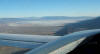
Owens Dry Lake
Looking south over Owens Dry Lake Bed (not too dry, actually) just south of Lone Pine |
|
|
[ Back ] [ Up ] [ Next ]
Copyright © 2005, All Rights Reserved, Marc J. Zeitlin